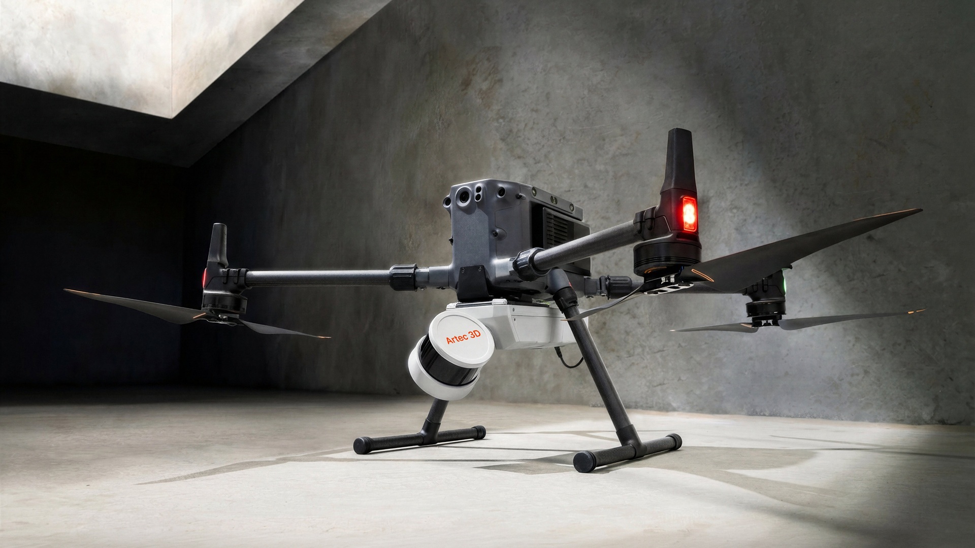
Artec 3D launched Artec Jet on April 3, a SLAM-based mobile LiDAR scanner for site-scale capture at 10 mm accuracy indoors and underground, including environments the company describes as "too extreme for human exposure." The 1.57 kg device supports seven deployment modes, from handheld to fully autonomous drone, and ships alongside a new processing platform called Artec Twins.
The scanner combines high-density LiDAR with SLAM positioning to achieve 10 mm accuracy indoors and detect changes as small as 5 mm. Engineers working in tunnels, underground mining, or confined industrial facilities will note the GPS-denied operation specifically. The system maintains real-time positional tracking with zero connectivity. Optional RTK accessories add GNSS-assisted georeferencing for outdoor work, reducing accumulated drift. A 360-by-290-degree field of view captures full volumetric geometry in a single pass, with optional video cameras adding color data. IP65-rated, the unit operates from -10°C to 45°C.
What's new here is the autonomous drone mode. Artec Jet plans its own flight paths using SLAM algorithms and AI navigation, with proximity sensors that detect obstacles as small as 2 mm wires. When battery levels drop below safe thresholds, the unit returns to its launch point automatically, preserving both hardware and dataset. The result is confined-space aerial mapping without a pilot in the loop.
Artec Twins, the companion processing and visualization platform, converts raw point clouds into outputs in LAS, LAZ, PLY, DXF, and E57 formats. The software handles merging, georeferencing, and inspection within a single workflow, built for the large datasets that site-scale capture generates.
Artec Jet positions at the top of Artec 3D's hardware stack, above Artec Ray II for large objects and Artec Leo for component-level detail, completing an ecosystem that spans individual components to full construction sites. Pricing and regional availability were not disclosed at launch.